2022/2023 Directory available 1 July

The Official Directory of the Catholic Church is a fundamental tool for anyone working within the Church and for those in the wider community who seek to make contact. Continue reading...

Click here for more

Diocese of Sale

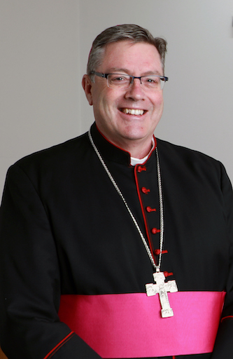
Bishop of Sale
Most Rev Gregory Charles Bennet MS STL
Bishop's Office
Sion House PO Box 1410
Warragul VIC 3820
Ph: (03) 5622 6690
Vicar General    
Very Rev Bernard Buckley EV VG

Vicar General

Sion House
PO Box 1410
Warragul VIC 3820
6 Witton St
Warragul VIC 3820
Ph: (03) 5622 6600
Episcopal Vicar    
Very Rev Denis O'Bryan EV

Episcopal Vicar for Clergy

St Thomas the Apostle Parish
PO Box 6089
Clyde VIC 3978
50 Heather Grove
Clyde North VIC 3978
Ph: (03) 5998 0947
Very Rev Bernard Buckley EV VG

Episcopal Vicar for Diocesan Pastoral Projects

St John's Parish
52 Waterloo Rd
Trafalgar VIC 3824
Ph: (03) 5633 1166
Tribunal    
Tribunal

Sion House
PO Box 1410
Warragul VIC 3820
6 Witton St
Warragul VIC 3820
Ph: (03) 5622 6600
Rev Peter Kooloos

Director

Ms Cathy Dougan

Diocesan Office    
Bishop's Office

Sion House
PO Box 1410
Warragul VIC 3820
Ph: (03) 5622 6690
Ms Cathy Dougan

Bishop's Personal Assistant

Boundaries

Commencing at the point at which the border between Victoria and New South Wales enters the sea thence westerly along the Southern Ocean to the entrance to Western Port Bay and including all islands belonging to the State of Victoria between Cape Howe and the said entrance thence by the east coast of Western Port Bay (including Phillip Island, French Island, Quail Island and any other islands in the said Bay) between San Remo and the point where Craig's Lane which is an extension of Hastings Road in the parish of Sherwood in the county of Mornington meets the said bay thence northerly along Craig's Lane and Hastings Road to Taylor's Lane thence westerly along Taylor's Lane and northerly along Lyndhurst Road to O'Connor's (also known as Thomson's) Road thence easterly along the said O'Connor's Road to Hallam Road thence northerly along Hallam Road to the southern boundary of the shire of Ferntree Gully thence easterly along the said shire boundary to its junction with the western boundary of the parish of Gembrook which is Cardinia Creek and thence easterly by the direct route to the junction of Diamond Creek and the western boundary of the parish of Tonimbuk East thence northerly along the said western boundary to its junction with the southern boundary of the county of Evelyn thence easterly along the southern boundary of the said county of Evelyn to the south east angle of the said county thence north west along the north eastern boundary of the said county to the Great Dividing Range thence following the Great Dividing Range to the south east angle of the parish of Hotham thence northerly by the eastern boundary of the said parish of Hotham to a headwater of the Cobungra Creek thence easterly by the said creek to the south east corner of the parish of Lochiel thence north by the eastern boundaries of the parishes of Lochiel and Nowyeo to the south boundary of the parish of Bogong South thence by that boundary and the south boundary of the parish of Tongaro to the Mitta Mitta River thence northerly by that river to the north boundary of the parish of Mowamba thence by that boundary east to the west boundary of the parish of Gungarian thence by that boundary north to the north west angle of the said parish thence by the northern boundary of the said parish and the northern boundary of the parish of Indi East to the boundary of the State of New South Wales thence along the said boundary southerly and south easterly to the Southern Ocean.